By Ivy S. Carpenter
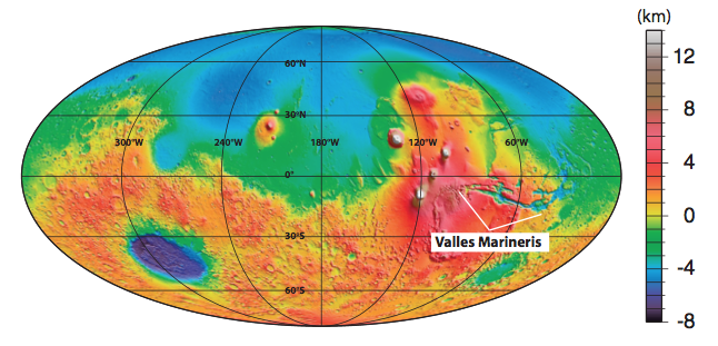
A giant gash scars the surface of Mars. Known as Valles Marineris, it is one of the largest and most recognizable topographic features in our solar system. Boasting a whopping 4000-km length and a depth ranging from 10 – 15 km, it easily dwarfs Earth’s Grand Canyon (which is a piddling 2 km deep). But despite the distinction of being the longest trough system in the solar system, its origin and formation remain enigmatic.
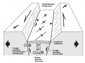
In a new study selected as Editor’s Choice in the 2012 June 29th issue of Science and to be published in Lithosphere, UCLA’s Professor An Yin suggests that the current structure of the solar system’s ‘grandest canyon’ is a result of left-lateral transtensional faulting, similar to that found in Earth’s Dead Sea fault system.

In his model, transtensional deformation (a result of mixed lateral and extensional movement) occurs as a zone of both strike-slip (horizontal ground motion) and normal (vertical motion) faults. The normal faults allow for the subsidence and subsequent infill of a deep trough area, while strike-slip faults offset these sediments and underlying rock.
In a geological mapping tour-de-force, Yin used high-resolution data from NASA’s Mars Reconnaissance Orbiter and Mars Odyssey spacecraft to define the shapes, orientations, and cross-cutting relationships of surface structures such as landslides, erosion, impact features, strata, marker beds and folds in the southern end of the trough.
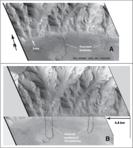
The results of the mapping effort show impressive trough-parallel left-slip offsets of 150-160 km throughout the Ius-Melas-Coprates fault zone. Offsets are seen clearly where numerous landslide deposits have been displaced sideways by ground motions (see image below). At a larger-scale, Yin identified a continuous, long (>2000 km) and narrow (<50 km) strike-slip zone with >100 km in total slip that appears strikingly similar to the undisputed plate boundary of the Earth’s Dead Sea fault zone. Some local trough-bounding faults may still be active, as they are seen to cut recent surface deposits and landslides.

An alternate interpretation made recently by Jeffrey Andrews-Hannah of the Colorado School of Mines proposes that Marineris is a subsidence feature that formed as a result of the uplift of the nearby Tharsis bulge (see Andrews-Hanna, J.C. 2012., JGR, 117, E06002 at www.agu.org/pubs). However, Andrews-Hannah’s model does not easily account for the physical evidence of horizontal as well as vertical motion in the trough. The scientific debate has already been highlighted by several sources even before Yin’s paper has been published.
Yin’s study raises the fascinating question of why a planet that has supposedly not had plate tectonics for the past 4 billion years should show a feature that looks convincingly like a plate boundary. Vast areas of Valles Marineris, not to mention the other 143,998,500 square kilometers of Mars’ surface, remain imperfectly explored. Accordingly, there remains huge potential for what geological observations may tell us about the structure of this and other planets in the future.
To read Professor An Yin’s full paper, download it here, see the August 2012 issue of Lithosphere or visit http://lithosphere.gsapubs.org/.
View the Editor’s Choice article from the June 29th, 2012 issue of Science, “Debating the Grandest Canyon”.
View the UK’s Earth-Pages coverage of the debate, “A mighty sag or a big wrench for Mars“.
Watch Professor Yin discuss some of his current research in his iPLEX Planetary Profile:
http://www.youtube.com/watch?v=rlsgQz3p1WM
Follow Iplex
